While I was messing around in photoshop, experiementing with different looks and designs I stumble across a very quick and realistic way to get quick aerial maps. While, for most people won’t find this useful for any practical use, I hope that someone can gain from this technique or at least be inspired in level design.
To start:
To start:

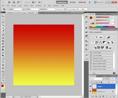
• Open up a new blank document and select the gradient tool.
• Click once on the gradient colors and I used Maroon -> Yellow -> Maroon gradient, because it was my school colors, but I’m sure there are many ways to do this.
• Paint a gradient on the first layer
Next Layer:

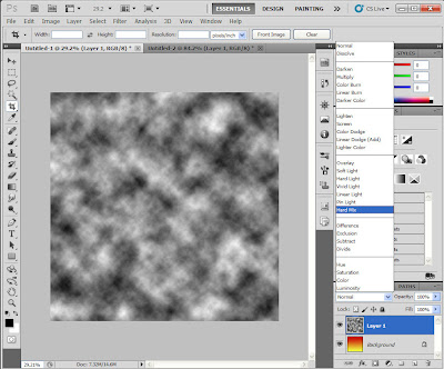
• Add a new layer.
• Goto Filter -> Render -> Clouds
• Set Blend Mode to Hard Mix
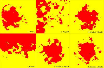
Now, I usually get 3 distinct colors for this outcome. In this example, yellow=water, red=land, and black=mountains=lakes=cities=be creative *Note: depending on how pure your colors are, you may get black and white splashes in your outcome.
How to get interesting results:

• If you like the general shape of the land mass but want to change around the shore lines just re-render the clouds layer and it’ll change things up a bit. Examples 4, 5 and 6 use the same gradient but different cloud renders.
• To get different types of land masses try using the different gradient modes. Making large Radial(Ex.1, 4-6) gradients makes very nice looking islands. Angle gradient (Ex. 3) makes a large land mass with a large water mass (almost continental looking). Then with the diamond gradient, you can get all land with the center focus being a lake with islands. I used the paint brush on the diamond gradient afterwards to get a more natural look.